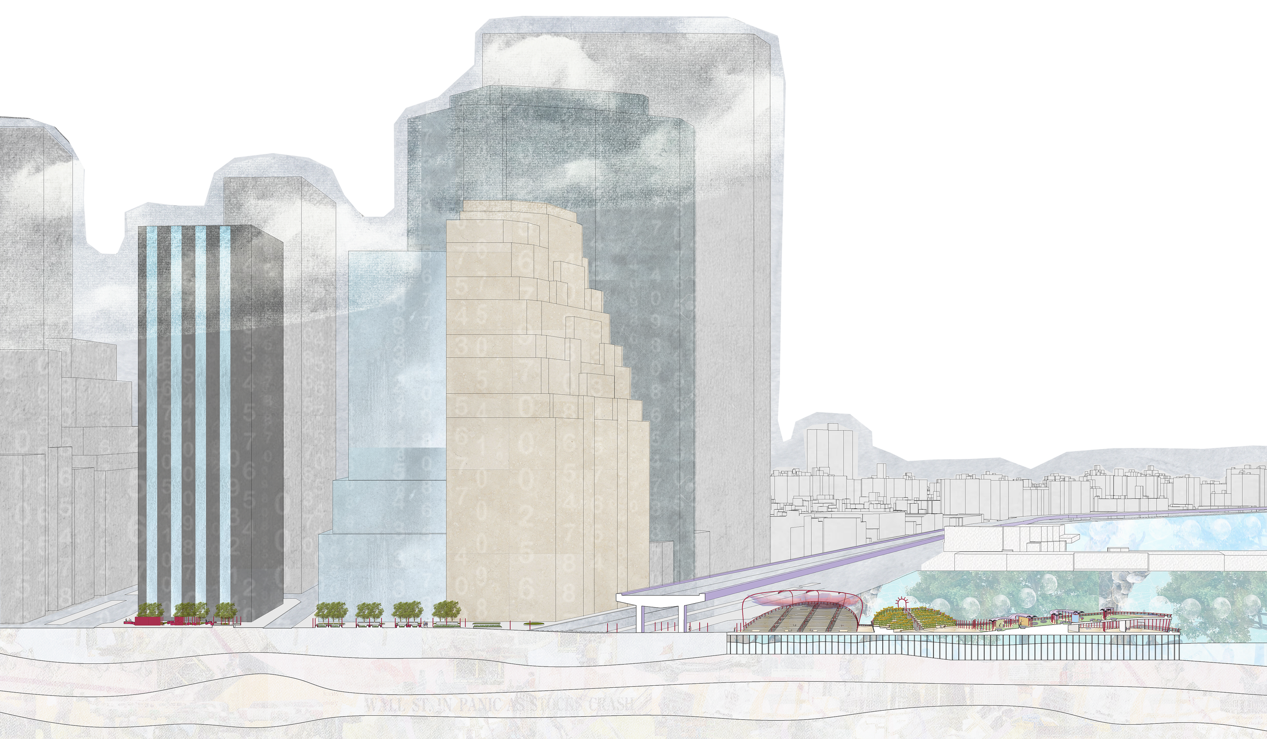
The Grounding Point(s): A Pier in Lower Manhattan
The Grounding Point(s) is a pier proposal situated in Lower Manhattan, specifically as an extension of Wall Street. It acknowledges the deep social and cultural history of what is today called Lower Manhattan, primarily through bringing the posts of the original wall of Wall Street back up to the surface, but twisting and morphing them, so that they no longer act as a device for exclusion and violence, but rather, they create spaces for people to come together in community and joy. In doing so, the Grounding Point(s) begins to tell non-dominant narratives of the people who once lived on this site, and how their experiences relate to the present. Like Wall Street is called Wall Street for a reason, and it is deeply connected to the skyscrapers that loom above.
PART 1: RESEARCH
The first step in my design process was to deeply research the site of the pier and its general surroundings. Through these five collages, I began to explore the daily lives of the people who have lived in what is today called Lower Manhattan by creating a new, more lively, kind of mapping. I broke them up into five general time periods, each collage building upon the next, and containing traces of the former. The first Collage begins with the Lenape, then moves through Dutch Colonialism, to Economy and Slavery in 18th-19th centuries, to the growth of the 20th century, and finally to what one sees/experiences when moving through the area today. An important note to make is that these collages touch upon both joy and systemic violence. The latter is important to learn about because it makes us question the world around us, but I emphasized joy as a theme in these narratives because it enables much stronger empathic connection between those of us in the present and those who lived in the past. These collages and the themes within them became the foundation for every design decision in The Grounding Point(s).

This first layers depicts parts of the livelihoods of the Lenape People on the land they called the land Manahatta, or “hilly island.”

This image illuminates the Dutch settlement in the 16th century, interacting with the Lenape people and their lifeways.

The British gained control over the land from the Dutch. This time period marks the physical foundation for the city we see today.

In the 20th century, the city was a mix of so many livelihoods and growth.

This final collage explores what its like to move through the site, Lower Manhattan and the Financial District, today. As the final image of the series, its important to remember that the city as it is today is a culmination of all of its histories.
PART 2: DESIGN OF THE GROUNDING POINT(S)
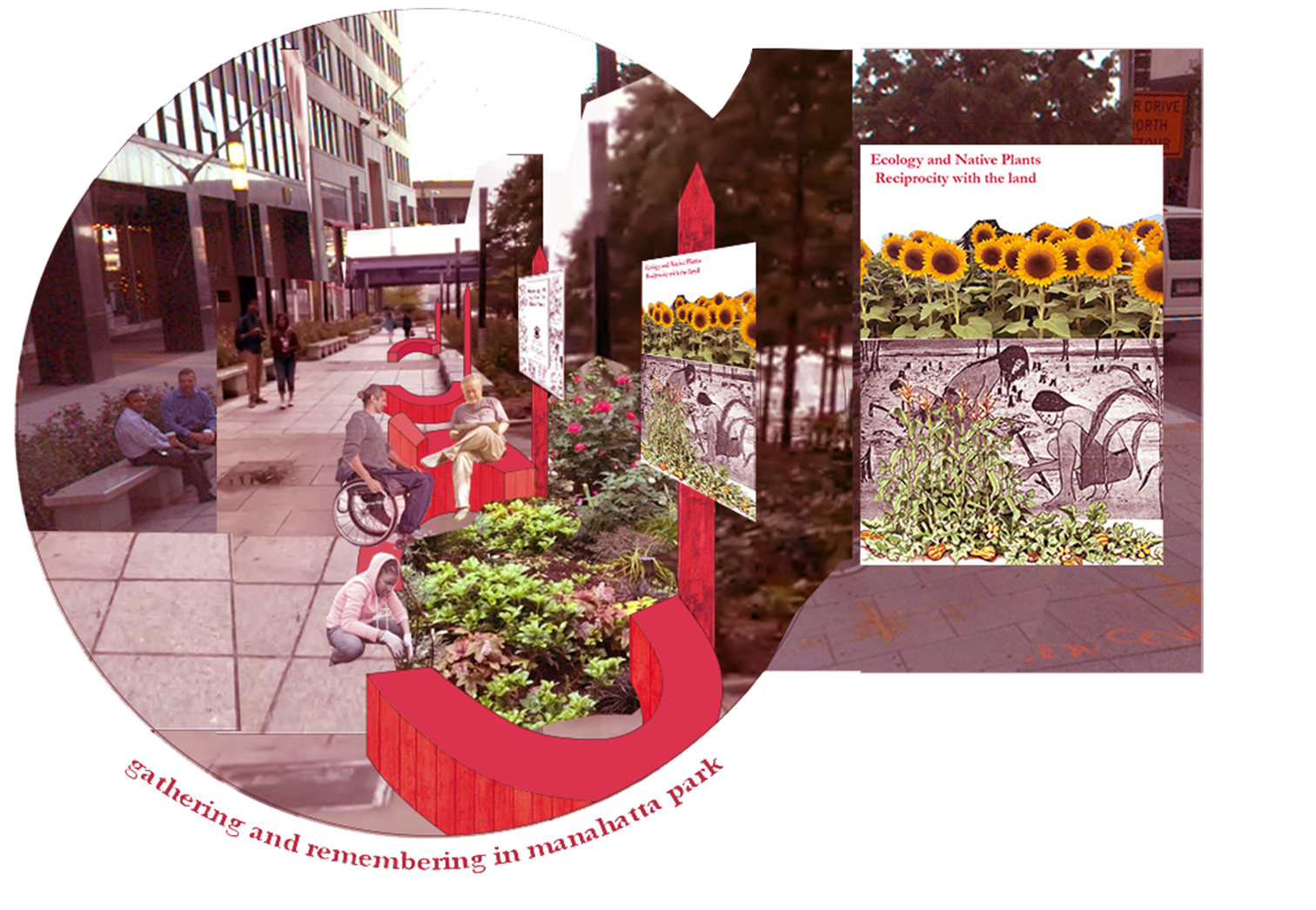
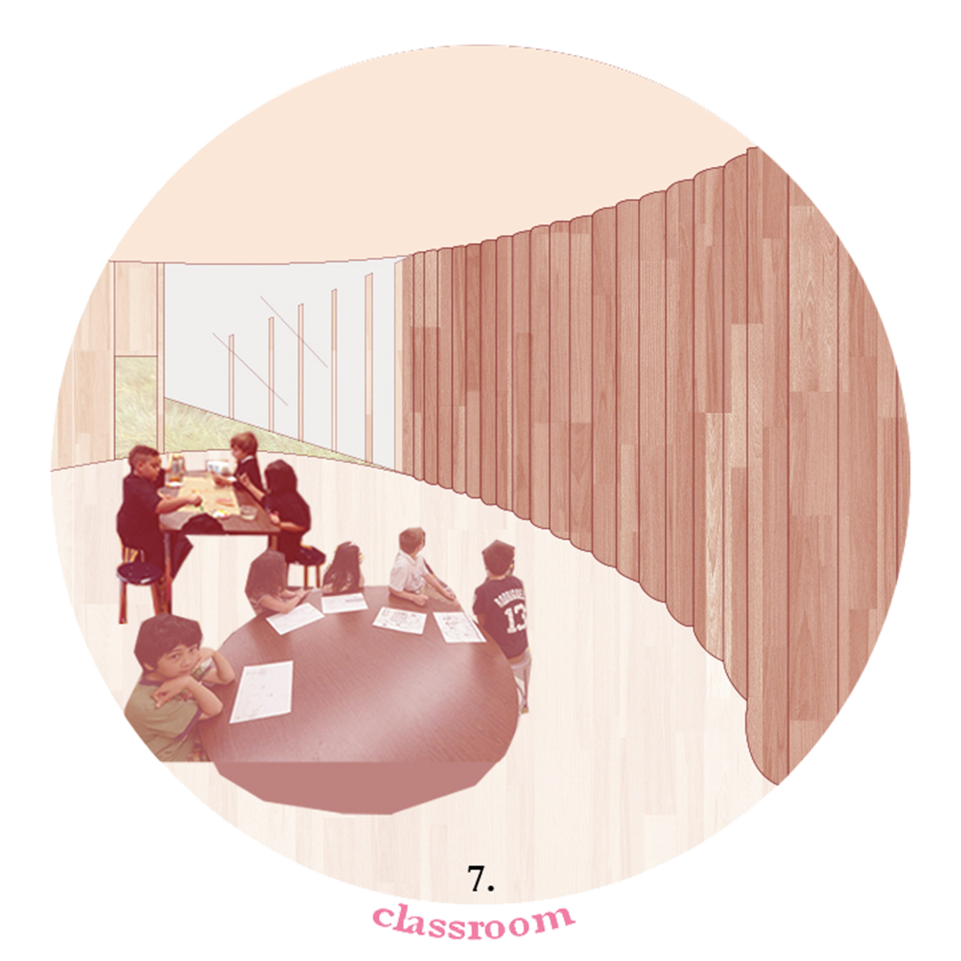
The posts begin in Manahatta Park. Their reddish color catches your eye, and you wonder why they are there and what they mean. They are dense at first- a true wall- and as you walk southeast towards the East River, they begin to stretch apart. You can weave through them. You cross the street, and the wooden-wall posts become benches— round benches that open up into a ( ) shape containing little community gardens in the center. People gather and talk to each other. You remember the old benches, long and straight and turn your back to the native plantings behind you. You keep walking, the posts lead you under FDR drive to a pier called The Grounding Point(s), where the bright posts create entire structures: a welcome and care center, an amphitheater, a place for food and nourishment, a sunflower garden, shelter overhead, classrooms, and exhibition space. They also support healing gardens and a reflective outlook back at the city. You see people laughing, crying, resting, and supporting each other. In the Welcome Center you learn that the posts are acknowledging the original wall of Wall Street, and suddenly, your relationship to the city changes.